Genova - Mont Blanc FKT
Following up on the Monte Rosa FKT, setting the record on the Genoa – Mont Blanc route was my second major goal of the year. Like the Monte Rosa route, this record starts from the beach in Genoa-Voltri on the bike and eventually transitions to alpine climbing to reach the summit of Mont Blanc on the French/Italian border. Also like Monte Rosa, the existing record of 14 hours 42 minutes was held by Marcello Ugazio.
But the Mont Blanc route is longer and more complex. The first 190 km on the bike are exactly the same, but in Pont Saint Martin where one turns right to go to Gressoney for Monte Rosa, one turns left up the Aosta valley for Mont Blanc. The road continues quite flat with some minor climbing until the end of the valley in Courmayeur, where it becomes quite steep and warrants changing from a time trial to a road bike. The bike phase is 290 km, which is 75 km longer than the Monte Rosa route.
After the bike, the climbing on Mont Blanc is more complex as well. Monte Rosa is a very simple climb on skis, with just two short sections that are steep enough to necessitate walking. Mont Blanc includes a jaunt over a long glacier, steep exposed climbing, several crevasse crossings, and scrambling on an exposed ridge.
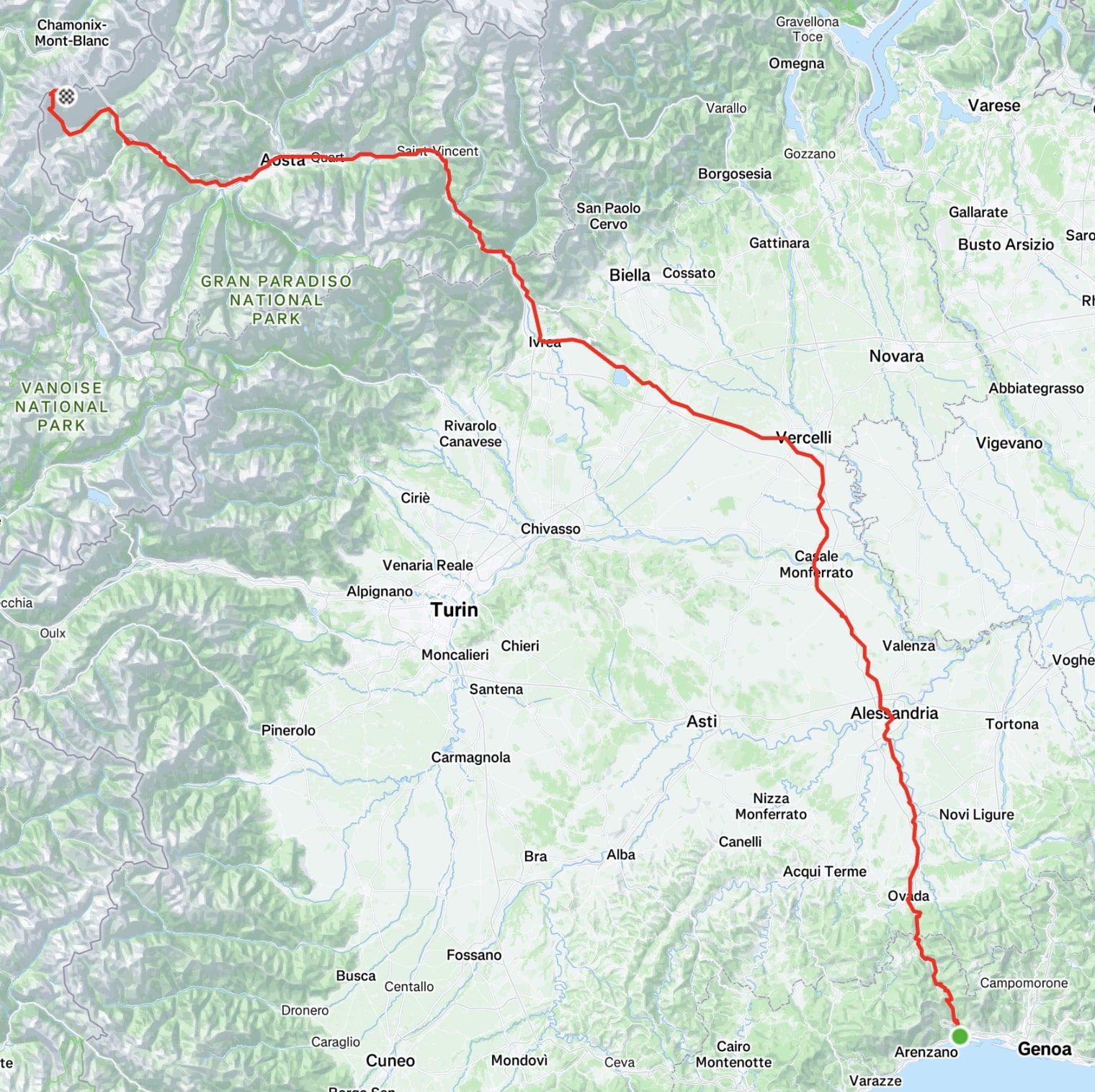 The GPS track of the route, just to give you an idea of the scale.
Although I set the Monte Rosa record by 27 minutes, I was less confident about Mont Blanc. Ugazio was absolutely flying on the bike: So much so that I was basically planning to fall behind on time and make it up later. I also like to think of myself as a very good skier, but when it comes to climbing and scrambling I am not always at ease on exposed routes. I also thought Ugazio’s execution was really tight on Mont Blanc. As an example, on Monte Rosa he took 24 minutes to change from bike to skis, while on Mont Blanc he took 11. So there were about 15 minutes “for free” that were not available on Mont Blanc.
Mentally, it was also hard to get out the door for another record. Doing one of these records basically means moving away from home for about a month to be set up on location for when the weather and conditions are good. I love being at home, and after being away for most of April and settling back in in May, it took a bit of willpower to get myself back out the door. I started the trip with a stop in Alagna for the double VK there, where I finished in 6th place, which at least gave a morale boost about my form.
After the race I went to Courmayeur for the final preparation. The weather was absolutely perfect that week, and on Thursday I climbed Mont Blanc on the route I would take during the record. I had seen the first six kilometers last year, as well as the summit ridge that the route from Chamonix has in common with the Italian route. But I had never climbed the most technical section between Gonella Hut and the Col du Goûter.
The training climb went great. Actually, too well; conditions were perfect and I was nervous that I was two weeks late for the record. But the whole support team was lined up for 2-3 weeks later. I sat in Courmayeur the next week trying to arrange a day and hoping that conditions would hold in spite of the ongoing heat wave.
In fact, this route is much more sensitive to conditions than Monte Rosa. The Glacier du Dôme is situated between the Gonella Hut and Piton des Italiens. It has several large crevasses and is south-facing, so it takes tons of sun during the day. There are two major factors in conditions: one long-term (seasonal) and one short-term (daily). During the winter, “bridges” of snow and ice form across the crevasses. In the spring, these are still there and one can climb over them, as in directly up the glacier. But by late summer these will have mostly melted and the route winds back and forth around the crevasses.
On a daily basis, the sun heats up the snow and ice. At night, if it is clear then the wet snow will refreeze due to evaporative cooling, but if it is cloudy then the snow will not refreeze. So not only is it slower trying to hike through slush, but it’s also more dangerous because those ice bridges can collapse.
While I was waiting for the support team, Europe was under a heat wave, Mont Blanc included. On several days, it was above freezing even up to 5,000 meters of elevation. I was really stressed that a lot of ice bridges would melt or collapse during this time and that it would not be possible even to attempt the record later.
As July 1st approached, I tried to home in on a date. Every forecast was saying something different and there were multiple weather systems colliding and making things difficult to predict. Even looking at a single forecast, it often changed every few hours. Some days it would say totally clear when I went to bed and I would get excited that we were on, then I’d wake up in the morning and it’d say storms all week.
Mentally and logistically, this was a difficult time. For Monte Rosa, we had a stable high pressure system in the area and could easily pick a day for the record. For such a large effort, you want to be well rested and have all the equipment clean and ready. That means a lot of sitting around to ruminate and fuss over details like, should I put a new chain on my bike now? Plus with people coming from Portugal, Spain, Ireland, and Germany (plus William and Bepi getting time off from work), it’s a big request to ask people to come to Genoa because you hope the weather will be good.
Eventually I became optimistic enough that between 1-5 July at least one day would be good, although it was still impossible to tell which day.
We lined things up for a 1 July start in Genoa and 2 July finish on Mont Blanc, but tried to stay flexible to last-minute changes. My sister and I drove to Genoa on 29 June so that we’d be ready to go.
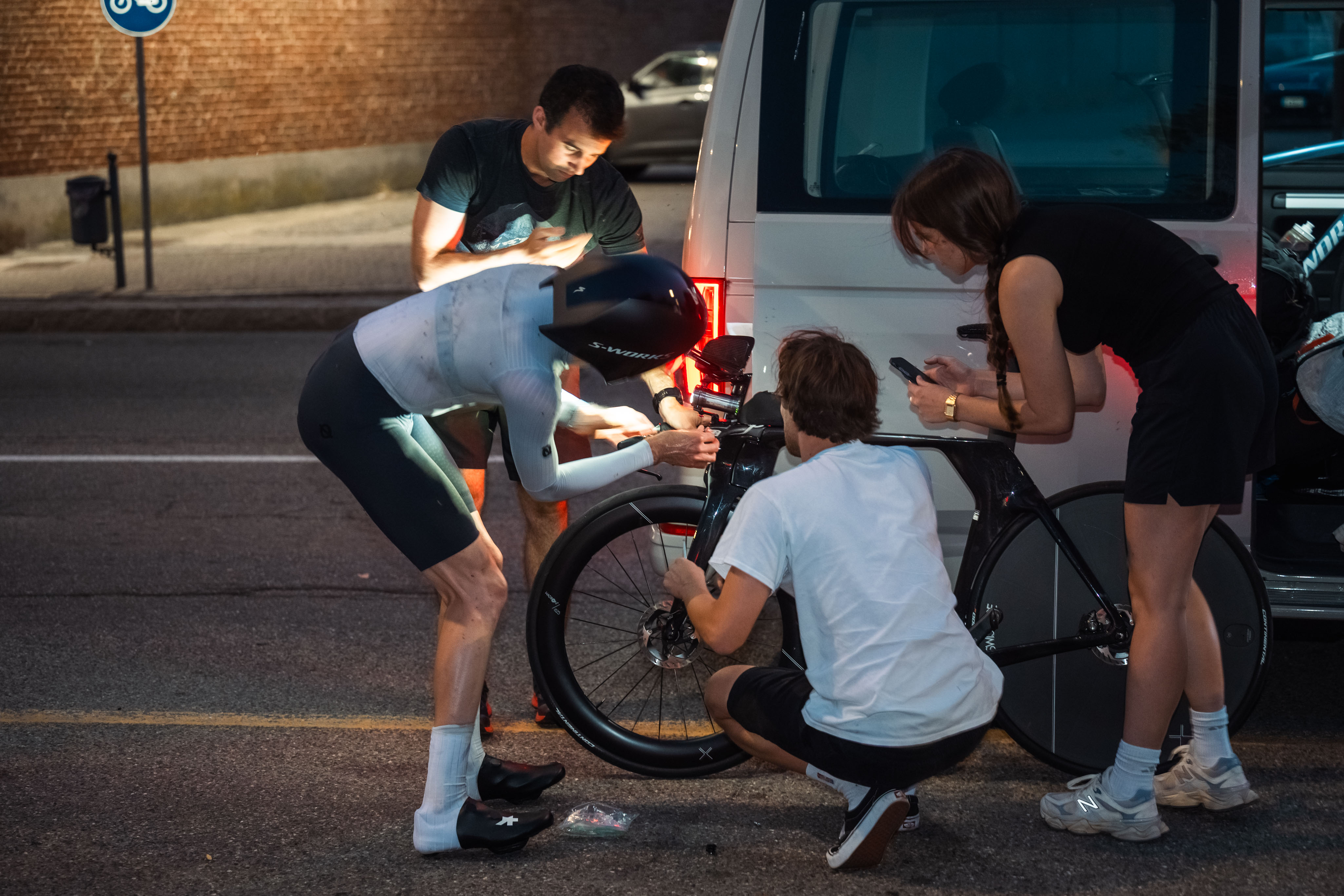
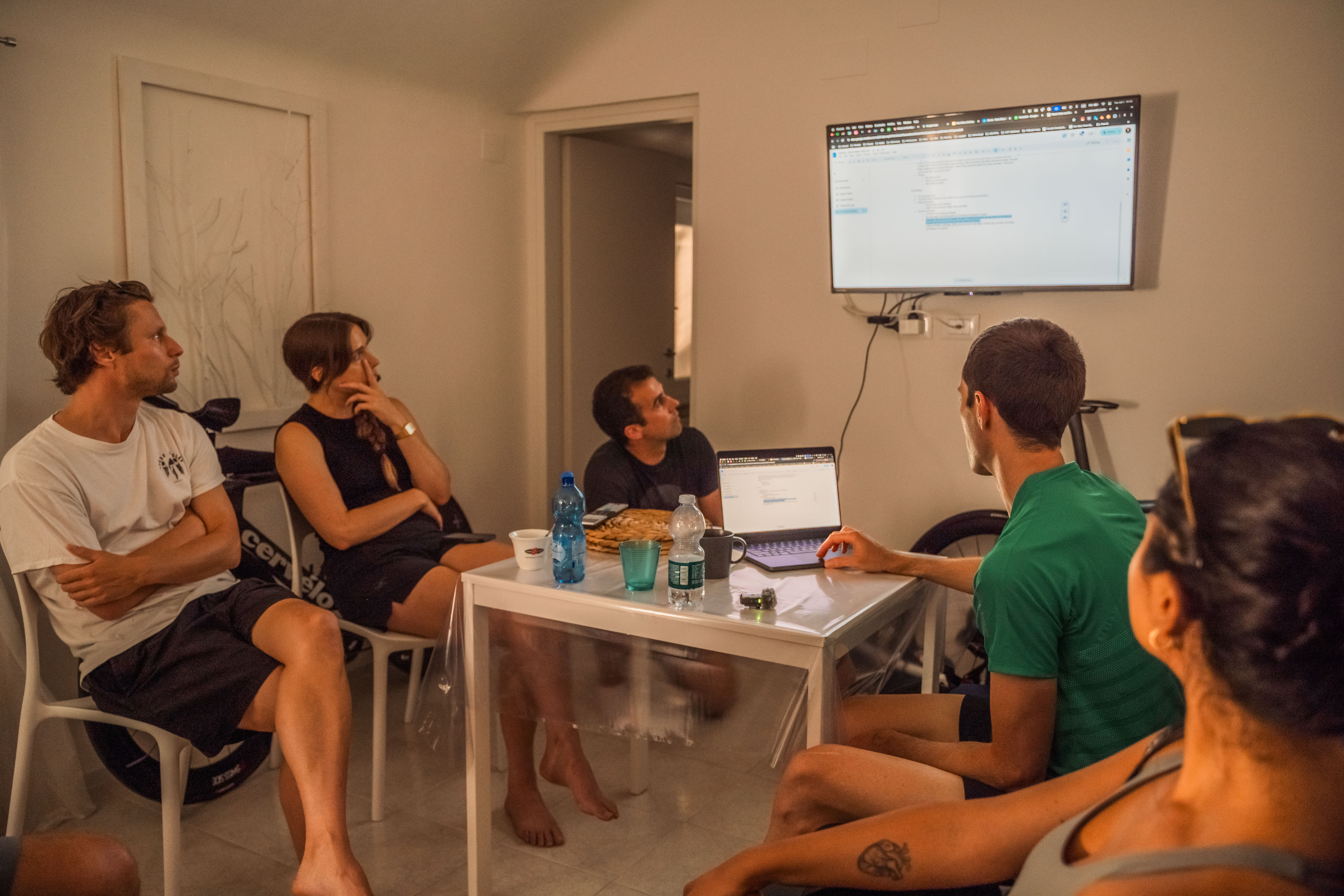 The bike team going over final details in Genoa.
The most important aspect of weather was having clear skies over Mont Blanc on the night of the record. Besides the safety issue of collapsing ice bridges and falling into crevasses, it would just not be conducive to a speed record. Climbing on ice and frozen snow is much faster than slush.
Finally, on the 30th, almost all forecasts agreed that it would be clear on the night of 1 July, but that clouds and rain could be moving in on the afternoon of 2 July. Being off by a few hours could risk the record (planned summit time was around 9 AM).
After a lot of discussion with my two climbing partners William and Bepi, we decided (only about five hours before the actual start) to go for it.
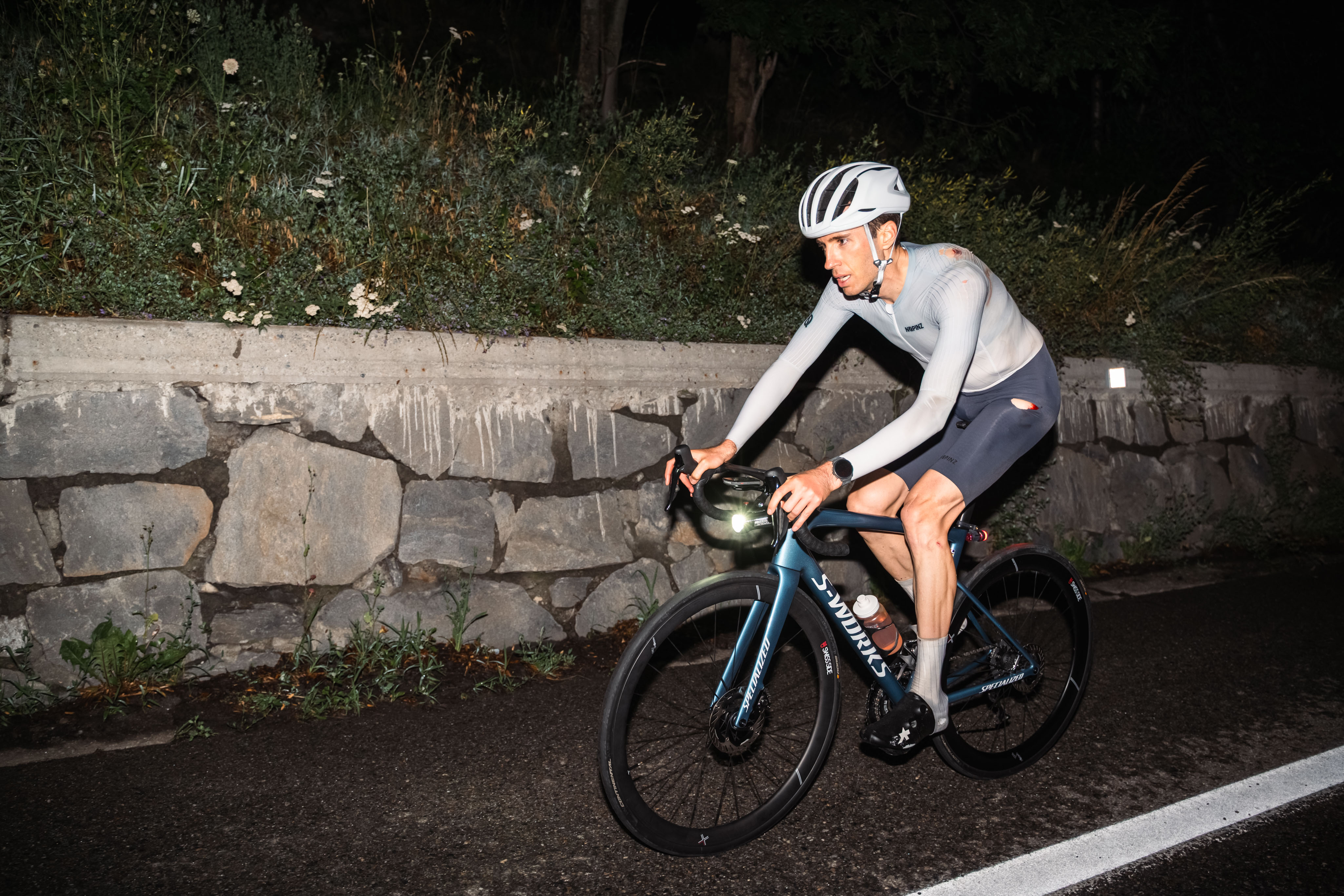
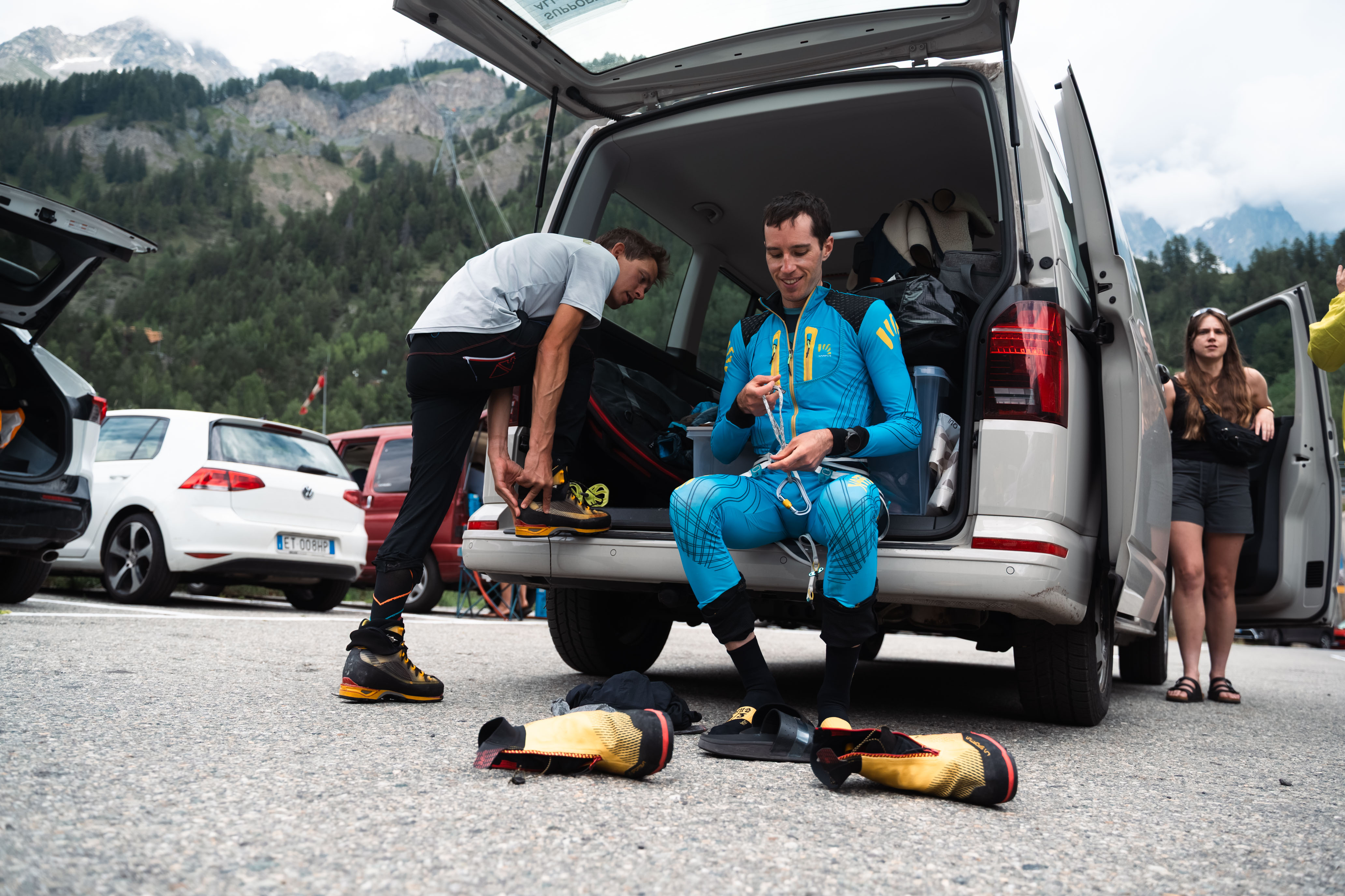
Start time: 18:55 in Genoa-Voltri.1 The bike support crew (Matej, Soraia, and Donal from Parity, my sister Leah, and Simon, Cori, and Ermanno from Key Pictures) assembled a few hours early in our vacation apartment a few hundred meters from the start, to go over final questions and load supplies into the cars.
I held back a lot at the start, riding up the Passo del Turchino a minute slower than when I did Monte Rosa. I was strict about keeping my heart rate under control, although it was abnormally high relative to the effort, probably due to the excitement and buildup. Down the back of the pass there was surprisingly little traffic and we followed the river to Ovada more-or-less stress free (and without being stopped by a train).
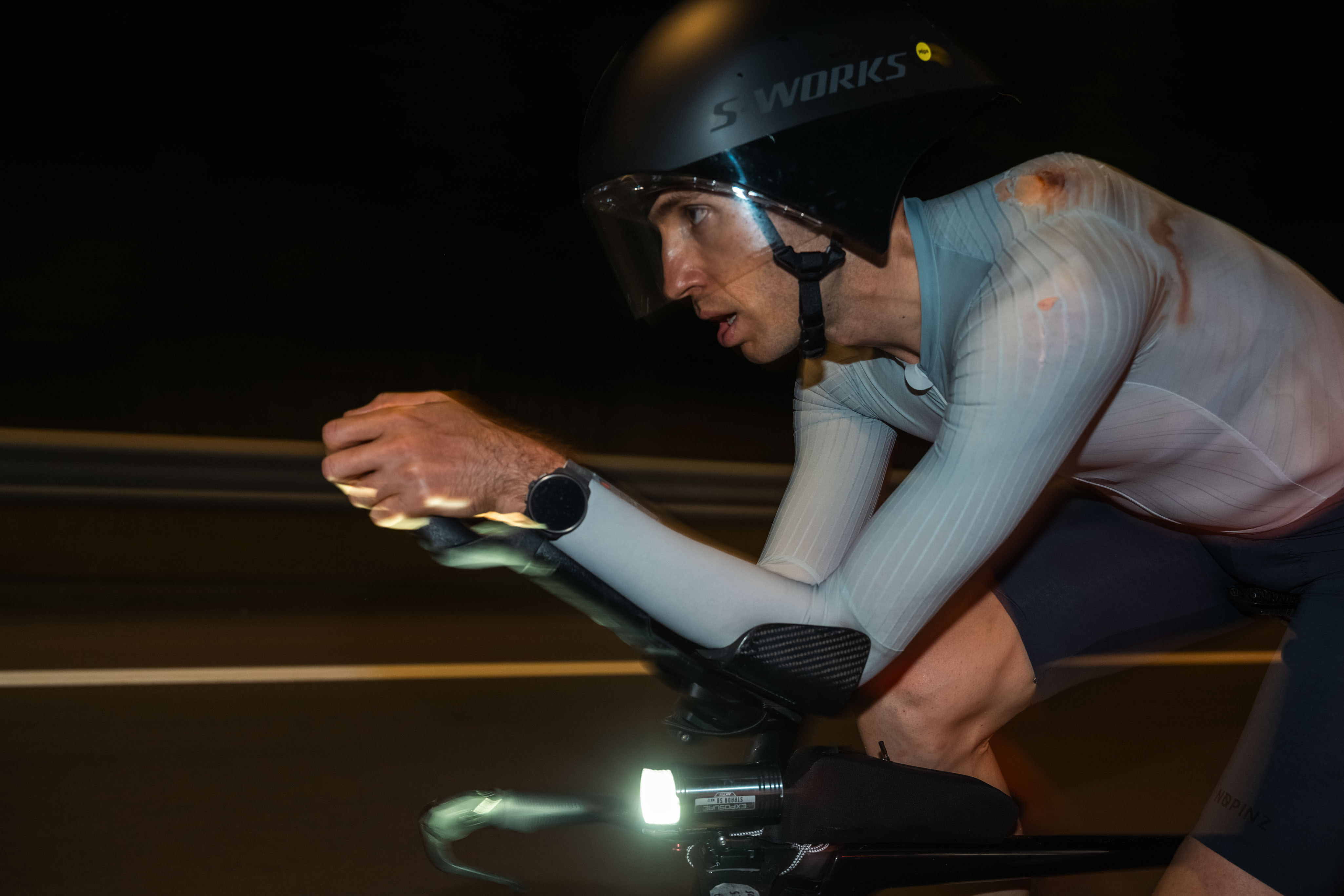
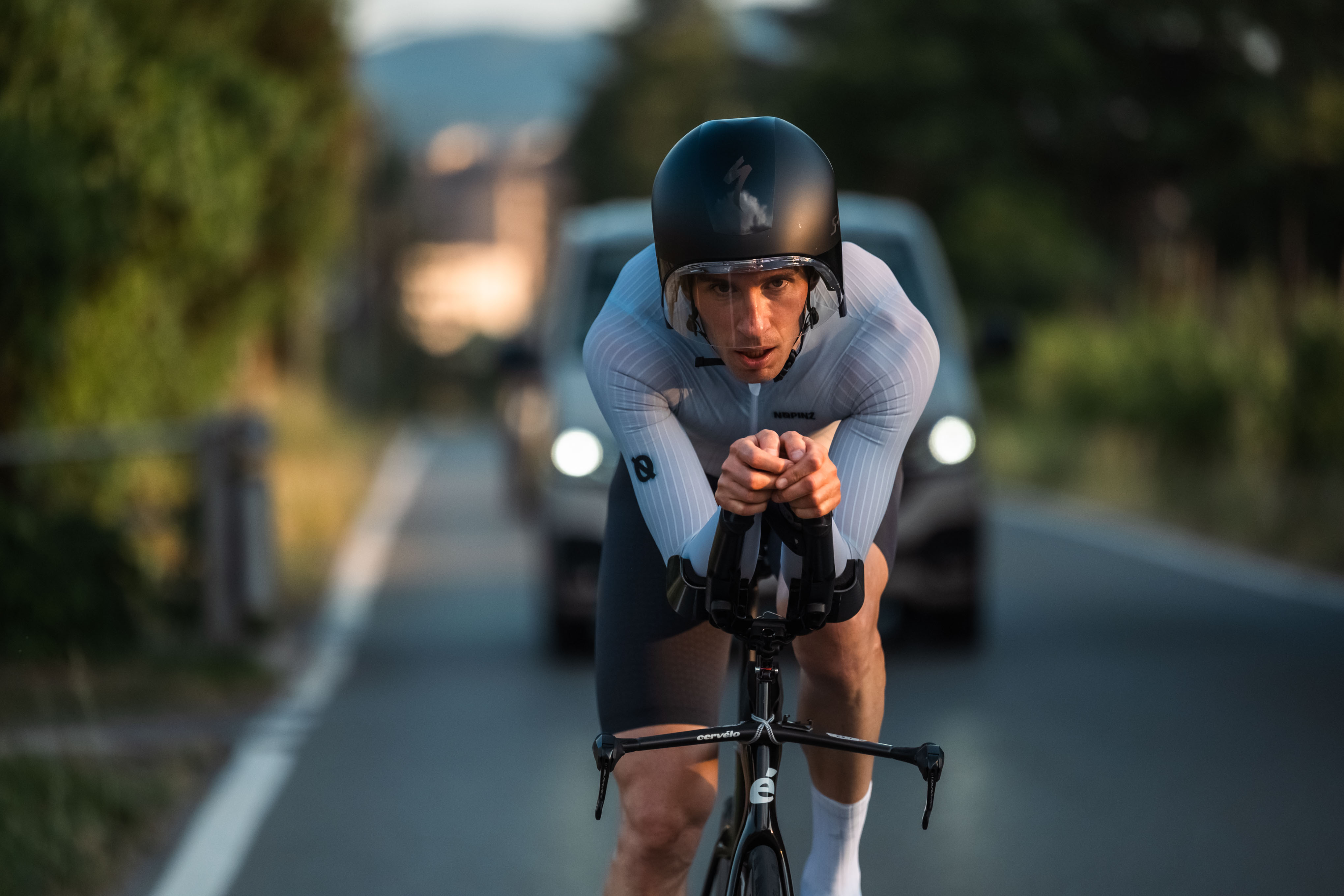 On the bike near the start, when everything was stress-free.
About 30 minutes later, a light rain started. This was a surprise, since the forecast said that it would be clear the whole way. But it was a welcome surprise. My biggest concern was the heat; there had not been any hot temperatures in Switzerland to train in so far this year. I even bought extra water and ice just for pouring over myself in this region.
But in the town of Predosa, I felt how slippery the roads were as I went through a few corners in town. Still, no panic, this route is rather direct and straight. But just a few minutes later I crashed in a traffic circle and slid across the road on my back. The road was like a skating rink, with no chance of staying upright.
My strategy was simple: Never stop moving. It’s OK to fall behind but just never stop moving.
I jumped up from the ground and collected my bike. Chain on, tires good. I got back on and started riding. Then I started to evaluate. How am I feeling? Hip is a bit sore, head is OK, skinsuit is torn on my left shoulder blade and hip. Bike is working OK, left shifter is a bit loose and rattling but working, left grip is scuffed up. I shifted through all the gears, all good.
As we approached Alessandria, I could really feel the sting of the road rash on my back, so I asked Donal and Soraia to drive into town and find some antibiotic spray. Other than that, I was back into the rhythm, and the rain had stopped.
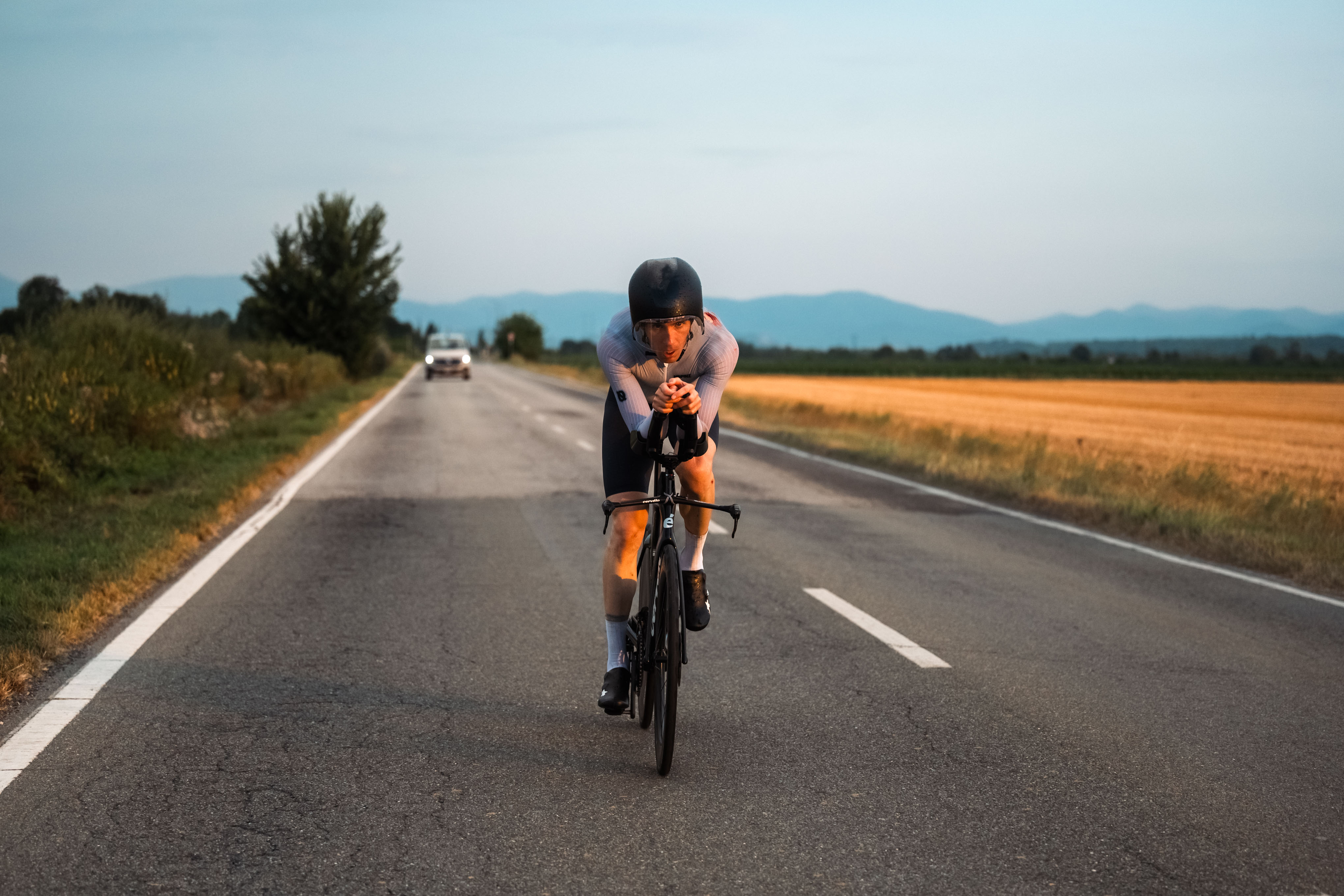 And post-crash, on the way into Alessandria.
Casale Monferrato comes shortly after Alessandria. This town is always stressful. The roads are riddled with potholes, cracks, cobblestone crosswalks, speed bumps, and sewer grates. There’s really no way around it though, as it has the only bridge over the Po river. And sure enough, while going through town, I heard a crack and then saw my headlight tumble to the ground. Another broken mount.
The team pulled over to help with changing the light. I realized that the impact on the ground had jammed the quick release pin to change the light. Then as we tried frantically to improvise a setup using a GoPro helmet mount stuck on my handlebars, the whole support team was mobbed by a thick swarm of mosquitoes. This attack was giving us more pressure than the clock to get moving again.2
 Everyone trying to rig a new light fixture under mosquito attack.
Down to one light, I set it to low – more of a “be seen” than a “see” setting – to make sure that the battery would last long enough. But at least we were moving again.
Out of town, I tried to ignore the full body itch from the mosquito bites and stay in the time trial position. But I was shortly granted a new distraction: storms. We were heading north toward Vercelli and I could see bolts of lightning to the left and right. Then the wind picked up. Then the rain started again. At one point I saw two flag poles, about 10 meters apart, with one flag blowing to the left and the other to the right. Controlling the bike was really difficult in these conditions.
I also had time checks in mind along the route and, although my plan was to fall a little bit behind on the bike, I saw that I was already 10 minutes behind and we were only 3 hours into it. But I tried to focus on the strategy: Just keep moving. My biggest worry was that the forecast was equally wrong about Courmayeur / Mont Blanc, but I assumed that if it were, then William would have written in the group chat to call it off.
After Vercelli the route turns to the West and we rode right into one of the storms. The rain intensified, and with my headlight set to low I just had to follow the edges of the road. In Pont Saint Martin, I babied my way through a left turn in a traffic circle. This is the point where the Monte Rosa route turned right toward Gressoney. Thirteen minutes behind now, but this is the point that the route enters the Aosta Valley. Climatically it would be a new region and the rain was starting to ease up.
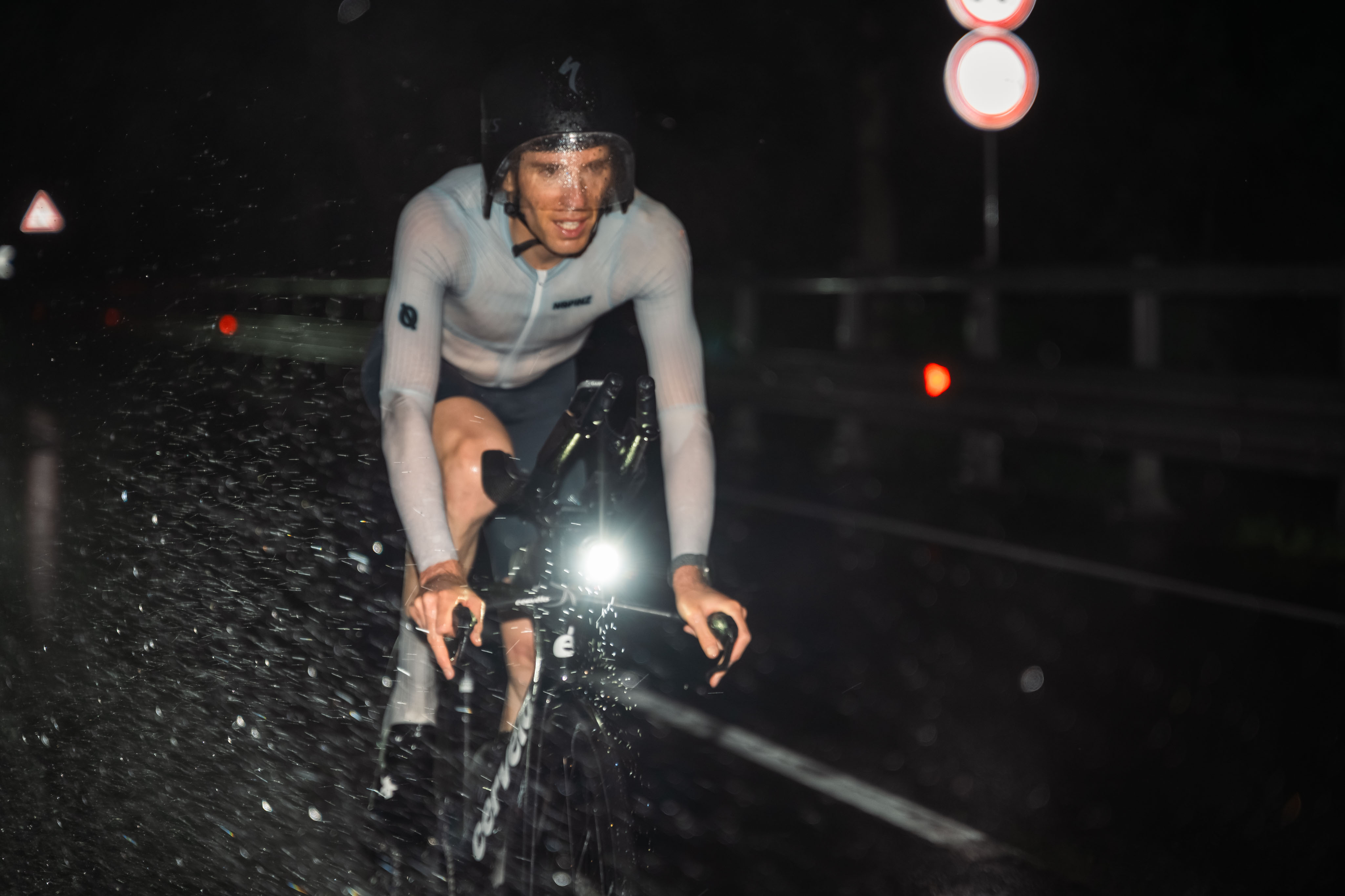 The rain.
By the time we made it to Châtillon, the roads were dry and I could see twinkles of light from the villages up the valley. I knew that the sky was clear and that we were on for Mont Blanc. I also started to feel a little tired. We came into Aosta at the 7 hour mark (1:55 AM and 21 minutes behind) and this was the only time in the day where I took a little break. Normally I eat a lot of energy food (bars and gels) but I had some salty trail mix and Coca Cola to mix things up. After five minutes I got moving again.
 Finally in the Aosta valley the rain stopped.
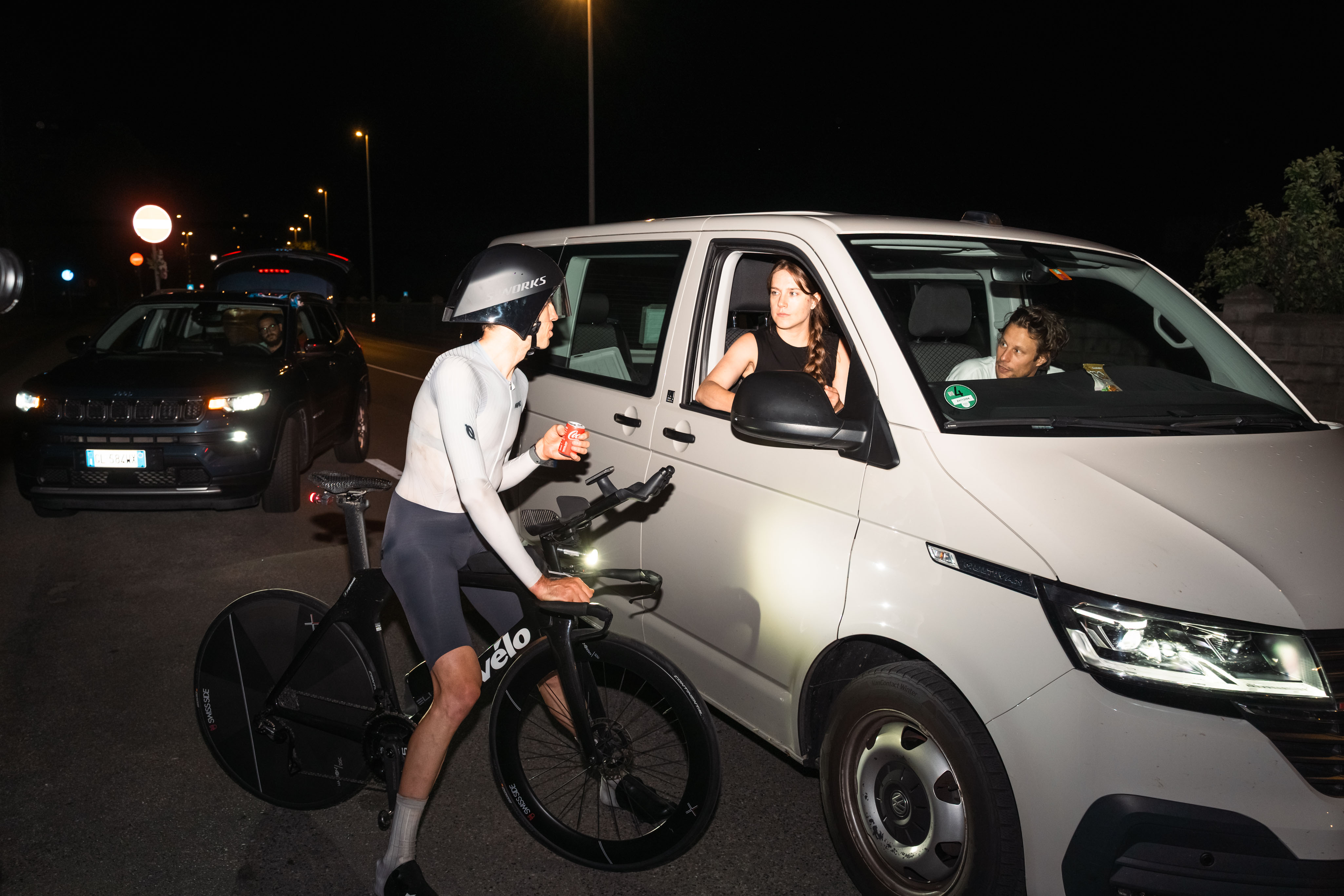 Coke break.
From Aosta the road climbs in a stair-step fashion with some light gradients and then flat sections where you can get going fast again. I was definitely feeling the fatigue. It was becoming difficult to keep the power on the climbs and also to accelerate over the tops.
My original plan called for a bike change after Courmayeur, when the steep climbing starts. But a few days before, I decided to make the change in Pré Saint Didier instead. There is a gradual climb there, and in a 40 km TT there is no question that a time trial bike would be faster. But after 8 hours on a time trial bike, I thought it would be good to make a change and stretch out.
And I was right. I felt instantly better on the road bike, and with the lower speeds of climbing I think it was the right tradeoff. I also got a fresh light and could see more than three meters in front of me.
But one thing made me nervous: When I got off the time trial bike and onto the road bike, it was really painful for my left hip (that I had crashed on). On a bike, you have a stable platform and your leg moves in a flat plane. But when climbing Mont Blanc on loose rocks, steep trails, and snow, the movement would be much more dynamic and require stabilization. How would it feel then?
 The only shot I have on the road bike. The photographers went ahead to set up for the hike shortly
after switching bikes.
The only shot I have on the road bike. The photographers went ahead to set up for the hike shortly
after switching bikes.
After Courmayeur the route leaves the main road and starts climbing up Val Veny, and this is where it gets steep. Of course hitting these steep slopes really stung, but after about five minutes I felt that I was getting into the rhythm of it. I cruised over the flat section at La Zerotta and then onto the final pitch: five steep kilometers up to Combal. A few sections really hurt, in particular the steep gravel where I had to stay seated, but I had ridden this climb tons of times in training and knew every inch of it. I started thinking of the transition and climbing.
I actually took back five of the lost minutes on this climb. But I was still 23 minutes behind on the record when I made it to Cabane du Combal, where I found Donal, Soraia, William, and Bepi waiting for me.
I knew the record was still possible, and my plan was to be a little bit down here, but I was hoping it would be 5-10 minutes, not 23. But still, just keep going as fast as possible. Compared with the Monte Rosa day, my energy levels were generally much higher and I was still able to eat and drink. In only 9 minutes, I was off with Bepi leading and William and Donal behind.
The start was awkward as I switched from pedaling on a stable bike to speed walking along a trail. I tripped a few times and felt some shooting pains in my hip when I had to catch myself or twist my leg around rocks. But it was tolerable and not getting worse, and after about 15-20 minutes I felt like I was coming into the effort as we entered the Miage glacier.
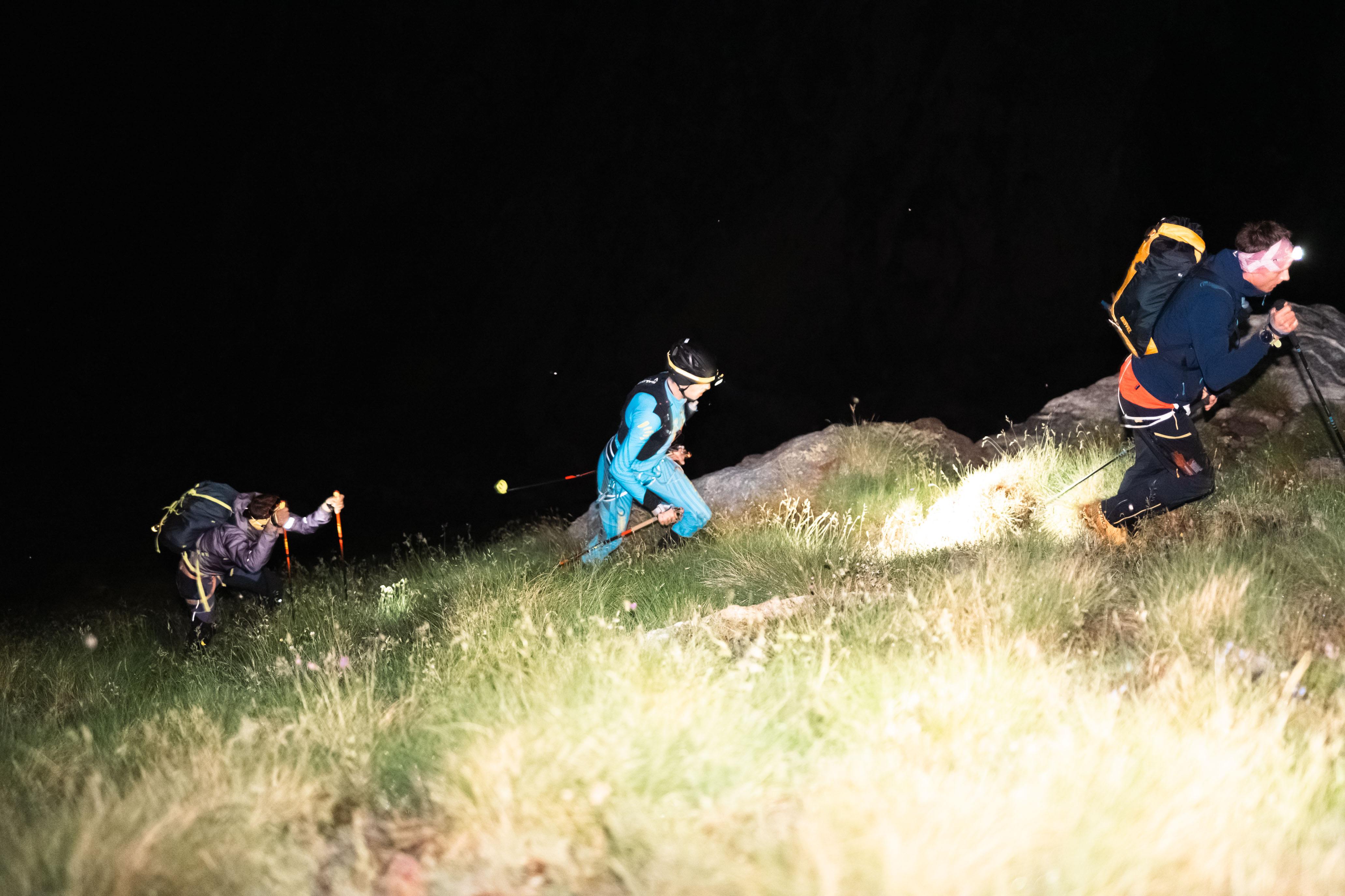 Bepi leading, then me, then William at the start of the hike.
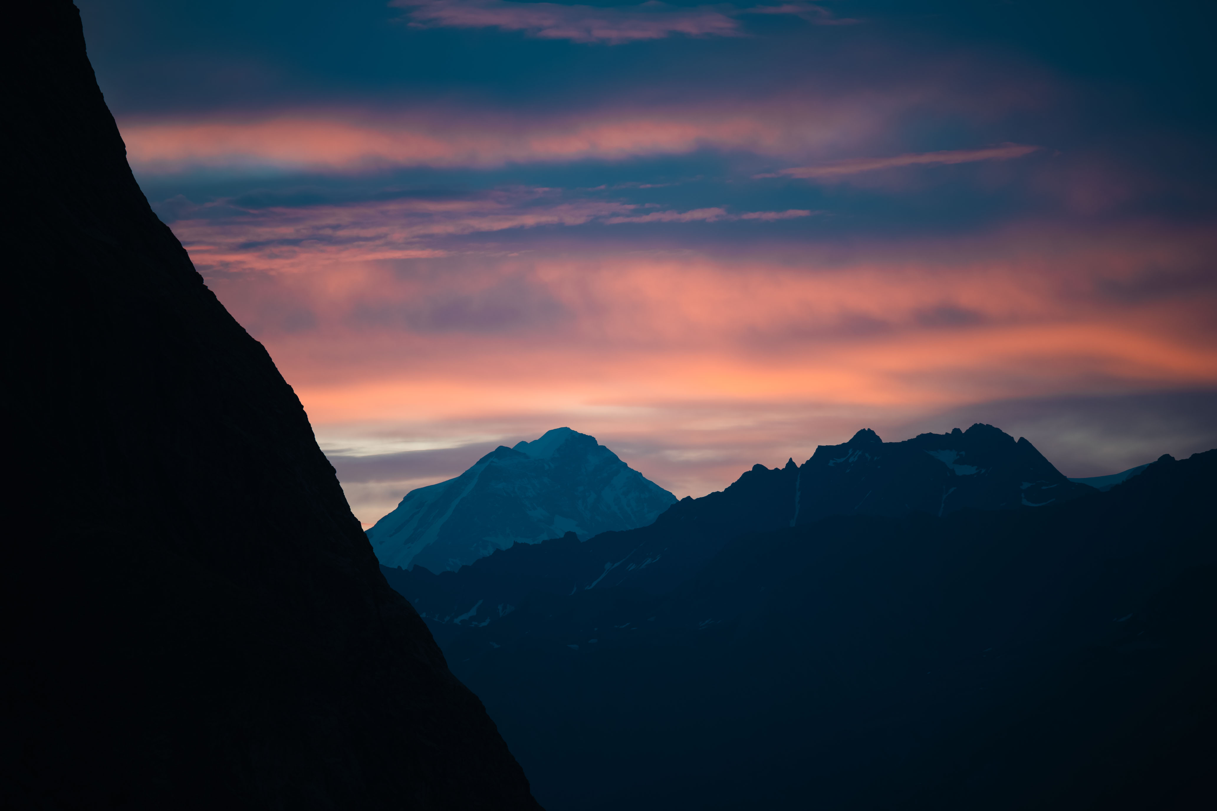 Sunrise.
How to describe the Miage? It’s about 6 kilometers long. It only climbs about 500 meters over this distance, so most of the time it feels relatively flat. However, it’s a pile of loose rocks and boulders on top of a sheet of ice that constantly shifts as it melts. There isn’t really a trail, and you can’t run on it. Mentally it’s easier in the night because when you can see the end, it always looks close but you never seem to get any closer. Better to just look at the next few steps in front of you.
From the record’s point of view, there isn’t much time to gain here since you are limited by foot placement rather than physiological thresholds. Mentally it’s hard because you’re not gaining elevation and you want to go faster. I tried to keep eating and drinking, and stay smooth. I had hiked across it four times in the last few weeks and found what I believed was the best path, so I just followed Bepi and my GPS track.
Near the end of the glacier, we finally hit snow. This is much easier to walk on than rocks so we picked up the pace and started to settle into the rhythm that would carry us to Gonella. It felt like we were flying up the trail / via ferrata. I had practiced this a few times – I am not the fastest with exposed moves – and it paid off when I breezed through the more technical sections.
 The snow at the end of the Miage glacier, where we could start applying some pace again.
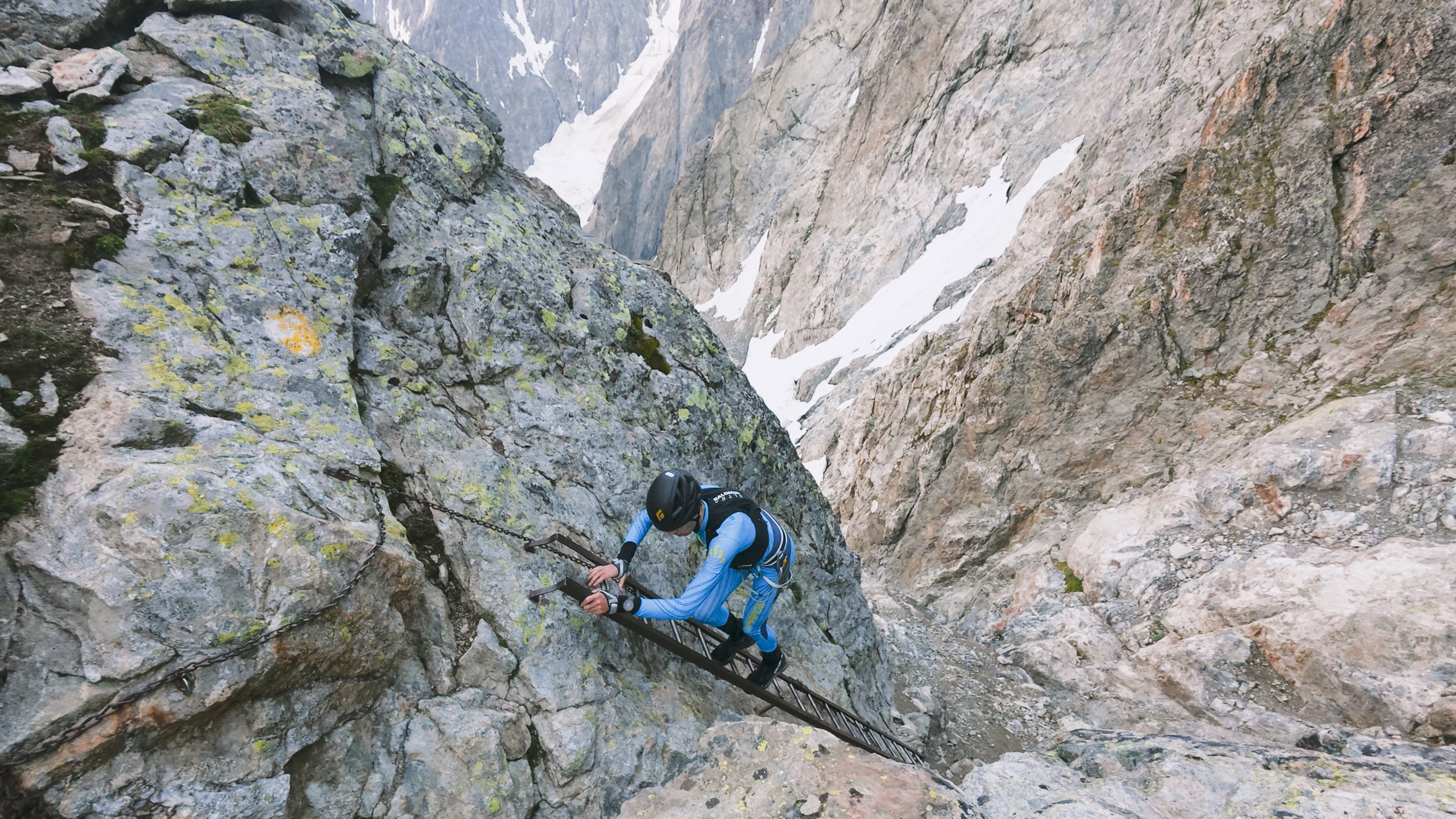 One of the ladders on the via ferrata up to Gonella Hut.
At Gonella the packs came off as we needed to change gear. Bepi got the rope out and got us tied in. William got my crampons out and ready; I would put them on about 100 meters later. I managed to eat a whole energy bar and finish a bottle to take a fresh one. William and Bepi each put on a jacket and crampons. In only three minutes we were moving again.
But our time from Combal to Gonella was even with Ugazio. As in, I was still 23 minutes slower overall. I tried not to panic because I knew this is where he started to slow down, but still, it was time to take risks.
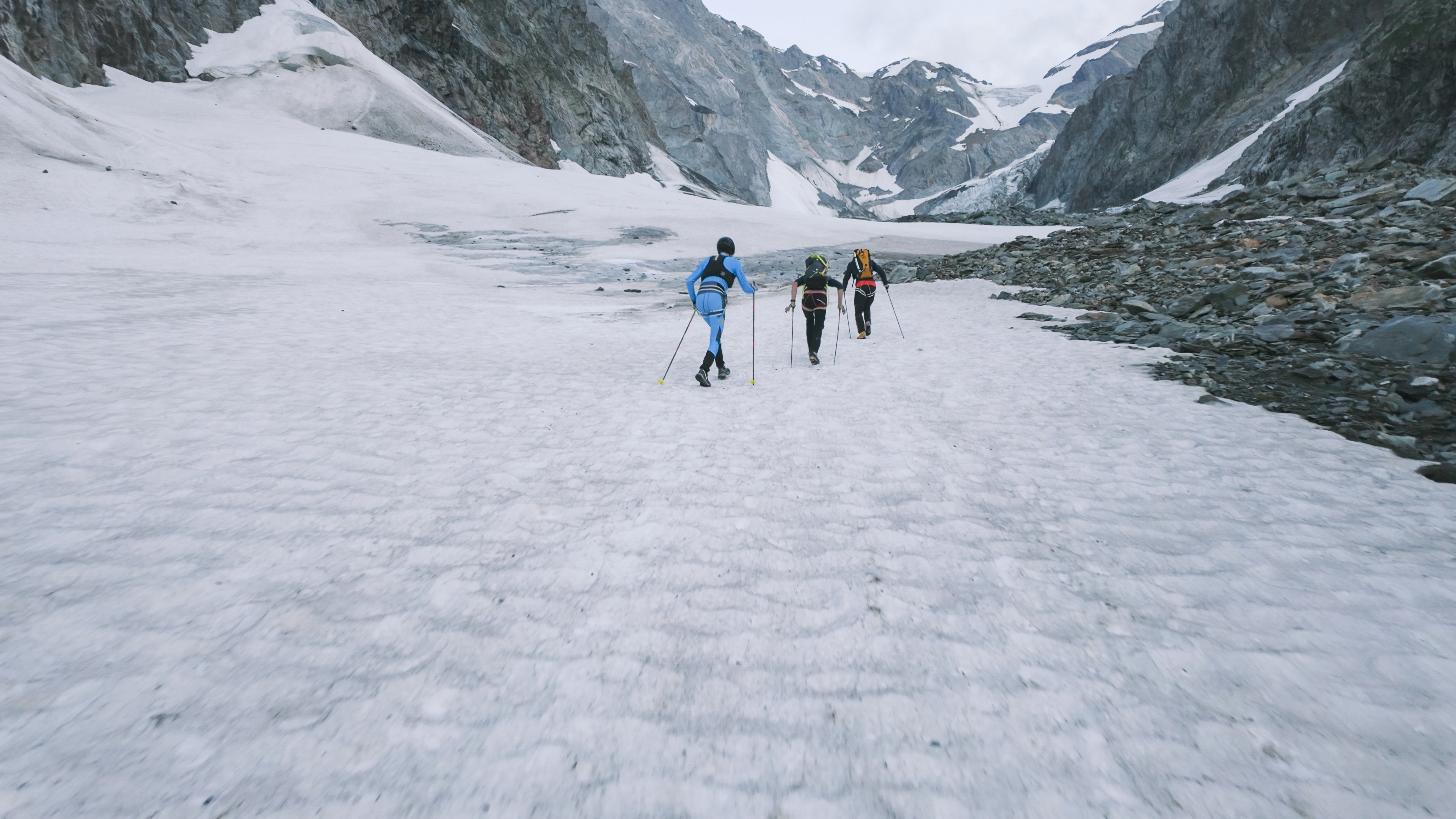
The next segment of the trip was from Gonella to Piton des Italiens. This section is completely on the Glacier du Dôme and climbs up to a mentally convenient 4,000 meters. We went full gas here. There are some crevasse crossings but I mostly remember them as a few big steps; I spent most of this section looking at my feet and following William’s footsteps. The pace was hard but I never felt like I needed to stop. I knew that I was gambling with how long I could sustain the pace, but this was the time to really push.
When we made it to Piton des Italiens, I checked my watch again: dead even with Ugazio. In about an hour and a half I had made up the lost time. And imagine that, after 13 hours, we were in more-or-less exactly the same position.
From Piton des Italiens to the Col du Goûter there is a mix of climbing on rock and snow. I made the decision to change from regular crampons to micro-crampons, as with running shoes they are much more comfortable on the rocks. I probably should have just done this from Gonella, so that change cost me a few minutes, but we hadn’t known the condition of the glacier.
There is a short descent onto the Col du Goûter and at this point I tried to run, but the bouncing motion brought on stomach cramps. I had to back off to a fast walk. There was still 600 meters to climb and I’d have to be careful balancing eating enough with my stomach problems. I was still on Ugazio’s time here. With the clock at 13 hours 34 minutes, I had 1 hour 8 minutes to make it. Theoretically that pace is easy, but with the fatigue levels and stomach cramps, I could not take anything for granted.
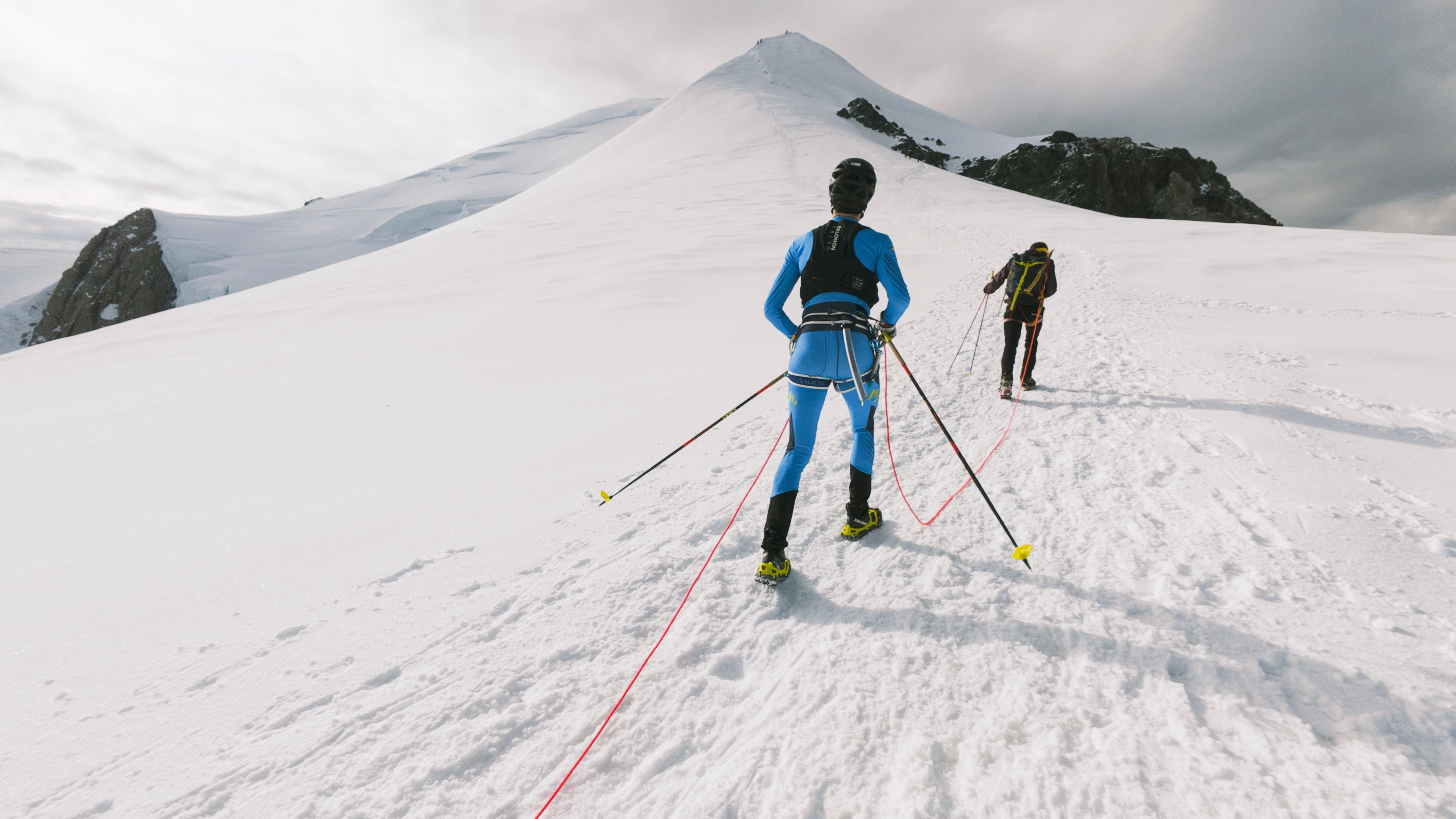 On the summit ridge after passing Col du Goûter and Refuge Vallot.
I’ve climbed this summit ridge many times and knew that it comes in bite-size chunks. Steep section, flat section, steep section, flat section, and so on. I was just trying to think, get over this section. We climbed the first half in 28 minutes. Clock at 14 hours 2 minutes, 300 meters left to climb in 40 minutes.
Following William I was on my limit, but just like on Monte Rosa, he was there when I needed the encouragement. I felt like I was holding myself up with my poles. It was hard to see ahead as I was bent over at my waist staring at the ground. I asked William to slow down just a little bit, and he shouted back, “No Joe, come on! This is the moment the record is made! Dai Joe, dai dai dai!”3
Finally the last steep section. There is about 100 meters along the ridge to the actual summit. Again I tried to run but got slowed to a fast walk. But I made it and stopped the watch: 14 hours 28 minutes 36 seconds.
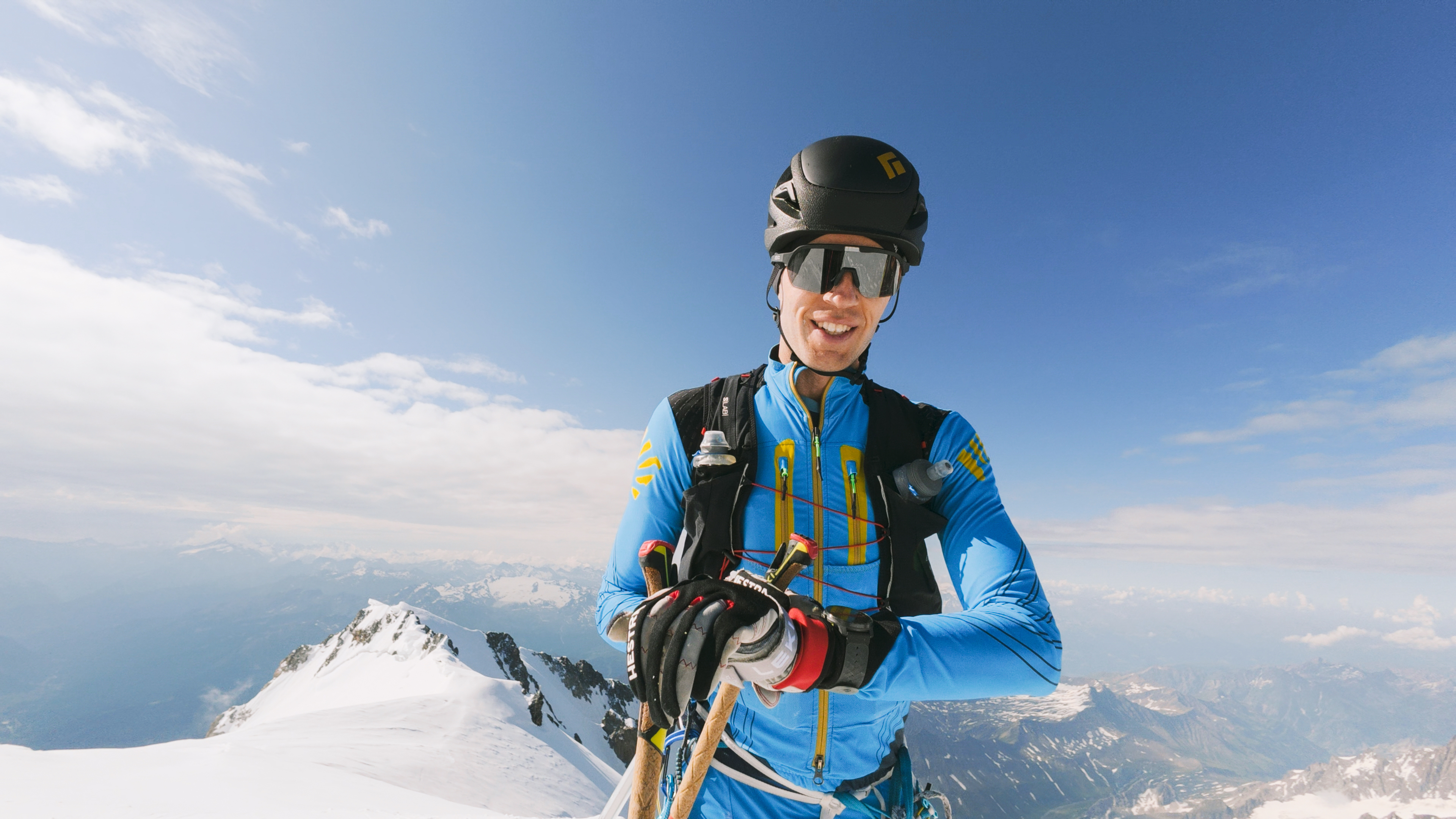 Checking the watch at the summit, relief that we made it in time and can sit down.
I had set a new record, taking 14 minutes off the old one. On one hand, breaking the record is binary, whether it’s by one minute or one hour. I knew there was a good chance that this would come down to the wire, so I feel happy with the outcome. On the other hand, I do wonder what would have been possible with good conditions and no crash or mechanical failures on the bike. Under 14 hours? But for this year, I accomplished my two big goals of records on Monte Rosa and Mont Blanc. Now it’s time to enjoy summer and think about the next goals.
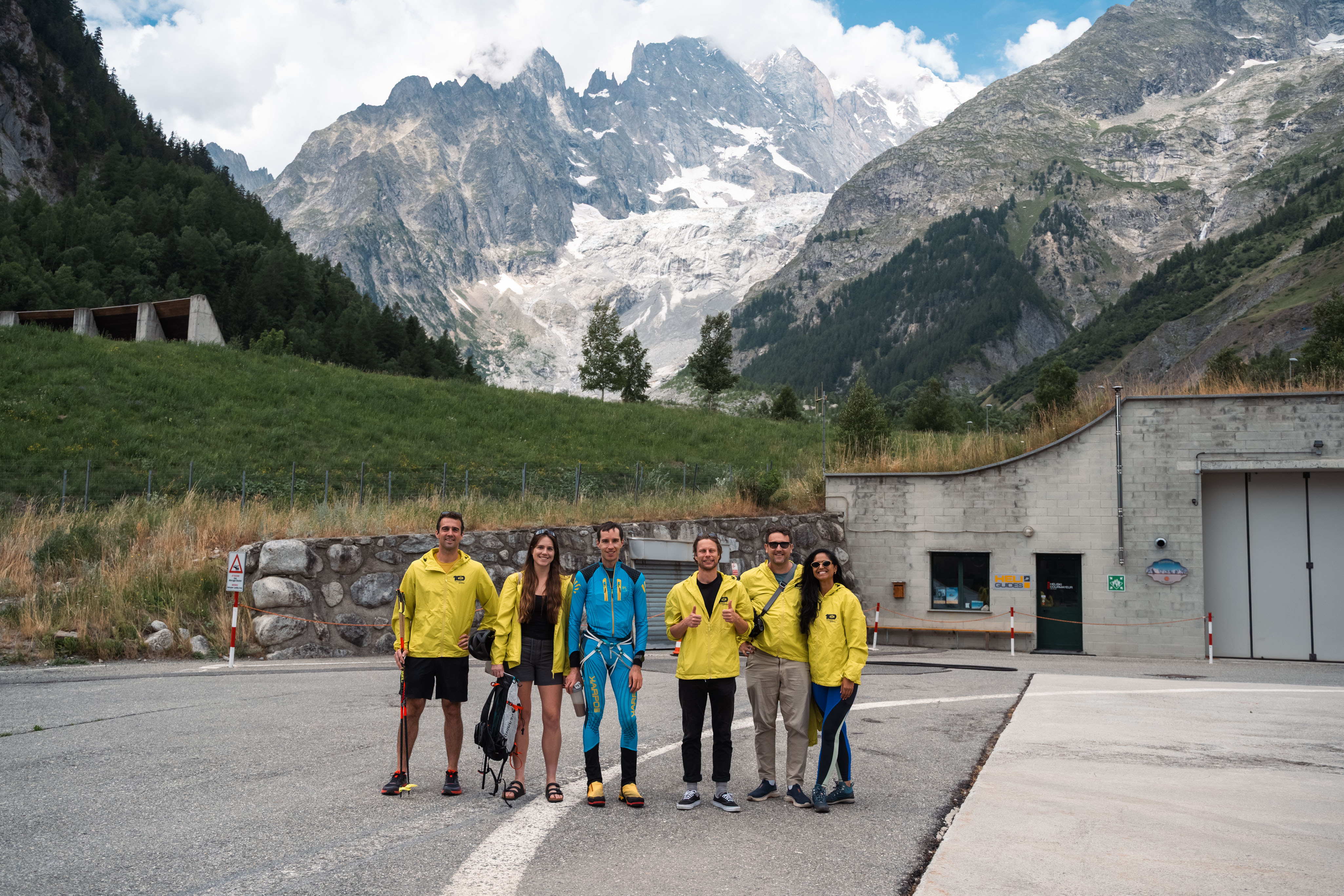 The bike team plus Simon after regrouping in Courmayeur. Unfortunately we never got a group shot
with William and Bepi in it too.
The bike team plus Simon after regrouping in Courmayeur. Unfortunately we never got a group shot
with William and Bepi in it too.
 William and I debriefing at the car. Probably talking about the top priority: Where to get lunch.
A Few More Shoutouts
- The whole support crew on the day: My sister Leah, Matej, Donal, Soraia, William, and Bepi.
- The photographers Simon and Cori and their driver Ermanno.
- The town and people of Courmayeur: I felt really supported and accepted here, from the town hall giving me access to Combal, to Matteo and Luca at Courma E-Bike letting me use their workshop, to Alberto Lorenzi and Davide Cheraz helping me find climbing partners.
- Eric Balog, for tons of discussion about strategy / gear / optimizations.
- Martin Zhor, for collaborating on preparation.
- My employer, Parity Technologies, for their support of the project, including hiring Simon and Cori and letting Matej, Donal, and Soraia spend time on this.
Footnotes
-
In case you are interested, the start time was chosen very specifically. Along the Mediterranean and in the plains, the biggest concern was the temperature, so I wanted to start as late as possible so that I could ride in the cooler temperatures of the night. On Mont Blanc, the biggest concern is thawing ice, so I wanted to start early to make sure that I was on the glacier before the sun. I settled on roughly 7 PM as a good balance. Then, there are three railroad crossings about one hour into the ride. I looked up the train schedule for the closest station and found a 10-minute window where I thought there was the lowest risk of the barriers being closed for a train. I chose the exact time of *:55 to hit these crossings between any trains. ↩︎
-
I’m not quite sure how to communicate in writing how thick this mob of mosquitos was. I’m not talking about trying to kill three mosquitos when you only have two hands, I’m talking 40-50 mosquitos on your body at any given moment. One time I wiped my hand up my leg and it just became red with smeared blood. ↩︎
-
Italian for “Allez!” or “Come on!” ↩︎